ArcGIS Online has an easy-to-use tool for delineating the watershed of a surface water feature.As an example, we will consider the Huron River in southeast Michigan. The Huron River originates near the suburbs to the north and east of Detroit, and along its course it flows through several cities before it empties into Lake Erie. It comprises several tributaries as well as numerous lakes. Land use adjacent to the river and in the watershed varies, from farms and pastures, to residential neighborhoods and subdivisions, to urbanized areas and industrial centers. Uniquely among rivers in the area, the Huron and its tributaries are also bordered by dozens of parks and state recreation forests. ArcGIS online offers many tools for analyzing the human impact on the river.
Once you have created a new map in ArcGIS Online:
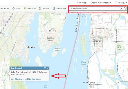
1. In the upper right search bar, search for Lake Erie Metropark. This park is just north of where the Huron meets Lake Erie.First, we need to delineate the watershed for the Huron River -- that is, we need to determine the boundary of the land area which contributes water to the Huron River.
The Huron River meets Lake Erie just south of the park. We're going to bound the Huron River watershed upstream of this point. To do so:
2. Click the Analysis button. 3. Expand the Find Locations dropdown. 4. Click on Create Watersheds.

The tool menu opens. To use this tool, we need to specify a point feature. It will determine the watershed upstream from this selected point.
5. Click the gray Draw button to the right of "Point features to use for calculating watersheds." 6. Click a point just upstream of where the Huron River meets Lake Erie. You will need to zoom in a bit. 7. Enter the name "HuronRiverWatershed" for the layer name. 8. Click on Run Analysis.
The watershed, which covers a significant portion of the Metro Detroit area, will now appear on the basemap as a shaded polygon. If you navigate to the Details tab and select Content, you will see that new layers have been created: the "HuronRiverWatershed" polygon and another layer ("HuronRiverWatershed - Adjusted Points") which is the point used to delineate the watershed.
Let's use a helpful feature to zoom out: the "Zoom to" feature automatically zoom in or out to the extent of a particular layer. To do so: 9. Navigate to the Details Tab and select Content. 10. On the HuronRiverWatershed layer, click the three blue dots to show a drop-down menu. 11. Click Zoom to and the map will zoom out to the full watershed area.
|
|
|