This workshop will introduce you to two apps designed to help you map and collect geospatial data using a mobile device like your smartphone or tablet and publish those data immediately to the cloud. The apps are called Collector for ArcGIS and Survey123 for ArcGIS. These tools enable you to take your mapping into the field while integrating simply with your other GIS software and maps. Plus, it enables groups of people to collaboratively map and to set up surveys to poll the public -- participatory mapping made easy!
- Free trial or organizational account of ArcGIS Online - Free download from App store (iOS) or Play Store (Android): Collector for ArcGIS. - Free download from App store (iOS) or Play Store (Android): ArcGIS QuickCapture.
Collector for ArcGIS 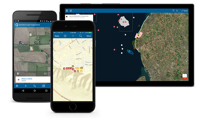 Collector is a free app that allows you to collect or update your geospatial data with any iOS or Android device directly into your ArcGIS Online account. It allows you to log your current location, and put the data you capture to work so you can make more informed and timely decisions. It allows you to use maps anywhere to ground-truth your data, make observations, and respond to events. It makes collecting data with a group of people very easy. Collector has lots of cool features: - Option for offline data collection - Enables multiple editors simultaneously - Records editors and timestamps - User roles: update only, create, delete, and sync.
- Geospatial design: domains, types, and subtypes - Participatory mapping with just a browser. - Collection of points, lines, and polygons.
Survey123 for ArcGIS 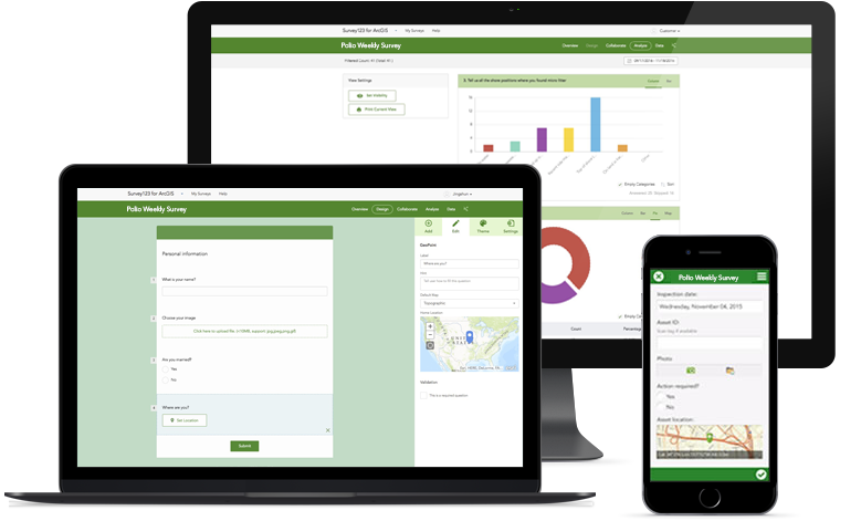 "Survey123 for ArcGIS is a simple and intuitive formcentric field data gathering solution that makes creating, sharing, and analyzing surveys possible in three simple steps: ask questions, get answers, and make better decisions.
Instead of being mapcentric, Survey123 works with forms (or surveys), which are frequently used to collect information for many different disciplines. Surveys—from simple to sophisticated—are authored with Survey123 and then shared in ArcGIS. Using the Survey123 mobile app, teams in the field can capture survey results with their smartphones and tablets. Surveys can also be completed and submitted in a web browser.
Data captured is immediately available for analysis in ArcGIS to help you and your organization make better decisions. Survey123 is a versatile data collection solution already popular with users in public health, education, public works, resource management, disaster response, and humanitarian agencies." (Derek Law, Esri).
ArcGIS QuickCapture is the fastest way to collect field observations. With this simple app, you can quickly record field observations from a moving vehicle while you scout locations, conduct aerial surveys, or assess damage. Send data back to the office for analysis in real time and eliminate time spent manually processing handwritten notes. ArcGIS QuickCapture is integrated with ArcGIS, so new data from the field can be used instantly for better decision-making. ArcGIS QuickCapture has lots of cool features: - Record field observations on your mobile device from a moving vehicle - Perform fieldwork faster and more efficiently than ever - Get better results with accurate, real-time data from the field - Effortless to use and easy to configure
|
Elham Masoomkhah, Mar 12, 2021, 9:48 AM v.1 |